
On Sunday July 16, I decided to tackle Grand Chavalard (see this page for a description and maps) . My aim was to start from Erie and make it to the top in under 2 hours.
The first part of the route is easy: a wide, flat trail, gently going upwards. It follows the cliffside and thus offers a great view over the valley. It also offers a great initial conditioning for looking down extremely steep cslopes. The technically and physically easy part ends when you reach the nearly invisible path that leads up to the avalanche barriers.
The trail to the barriers is on a 45+ degree slope and it zig-zags a lot - it is also slightly inclined and requires a sure foot, but is otherwise not too difficult. If you are afraid of heights you will understand it when you have arrived at this point.

Later on, the trail arrives at a large rocky crevice that is extremely steep and that requires some experience, although it is not particularly dangerous in dry weather (but I wouldn't try it after a rain). Many crows flied overhead, surprised by my ascent. After considerable effort I arrived at a slightly easier path onto grass, just under the avalanche barriers.

Going through the avalanche barriers was fun! The path was steep and went at some places around the barriers, while at others there little doors through which it passed to the other side. At some point you exit the barrier region.. and the view is magnificent:

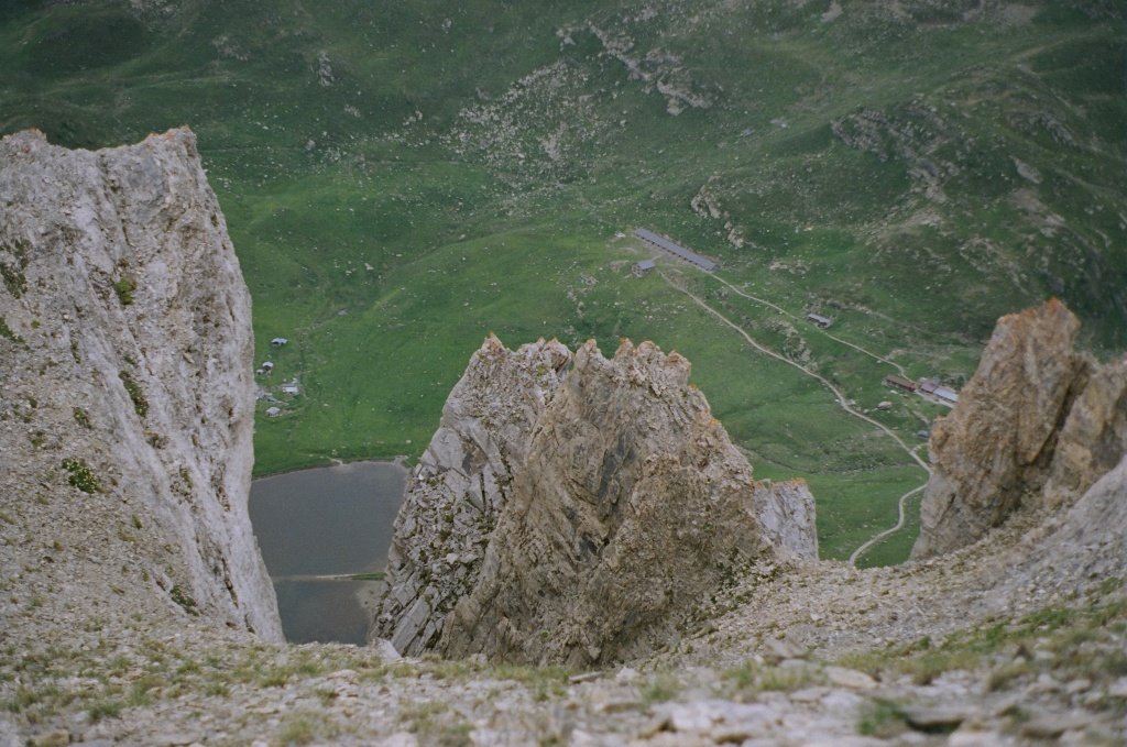
A bit more walking and you find yourself at the start of the last part of the route... with a view down to the lac inferieur de Fully.
 The trail is not so steep here, but at some point it enters rocky terrain and the lack of oxygen starts to become noticeable. However, you do get some great views. I think the two stones far away are the two towers: Tour d'Ai and Tour de Mayen.
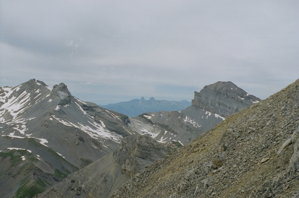
Further on is the lac superieur de Fully.

And finally... the peak - the final part is quite difficult and it is very easy to go off trail by mistake (as I did). Unstable and amazingly sharp rocks make going down extremely difficult. I personally had a hard time as I lost the trail amidst the confusing rocks and stopped just 50 meters shy of the cross itself, findind no plausible way of reaching the top. Going back down while being off-trail was difficult due to the loose rocks and soil and the near-certainty of death should you fall (either by tumbling down the very steep slopes, or getting stabbed by the blade-sharp rocks).
 But it was fun!
You can view the rest of the pictures here
No comments:
Post a Comment