Sunday, June 14, 2015

Mitake to Mt. Mitake and Mt. Odake

Start: Mitake (300m)
Peak: Odake (1300m)
End: Mitake.
Refreshments: Mt. Mitake (900m)
Total distance: 20km

The hike begins from Mitake station; there is a river, where people do rafting, and some shops where you can equip with food. There is no running water available that I could see.


The main route to Mt. Mitake is on a paved road. This has a grade about 15%, and is runnable most of the time, though it was quite warm.  Going up is easy enough, but going down is a bit of a pain.
 

After an hour or so, you reach a village with a large temple, where there is running water.  I used that to refresh my supplies. On the way down, I also got an extra snack from one of the shops.


As you can see, it was pretty cloudy; but the forest cover meant that little could be seen anyway.

There are plenty of intermediate peaks to visit if you wish. However, most of them lack a view.

The view from the top is unremarkable. Nevertheless, the climb is interesting as it has a few rocks and stuff to scramble over.

Overall, this took a bit longer than I expected; I was thinking I'd be able to run most of it, but I had to walk in many stretches. The terrain alternated from almost flat to quite steep, after the paved roads ended, while other parts had too many obstacles to traverse quickly. Nevertheless, I met a group of runners and joined them for a while in one of the less technical bits. Overall, it was a good day out.

Sunday, June 07, 2015

Mt. Takanosu ( 鷹ノ巣山 )

Start: Okutama, 350m
End: Mt. Takanosu, 1750m
Duration: 5 hours (fast hike / run)
Distance: 24km (both ways, with some excursions)
Difficulty: Easy, but long (from Okutama). The mud tends to be very slippery.
Access: There's a two hour-long 'holiday express' training for Okutama; it was totally full when I got in.
Trailhead: Multiple options, the longest of which is Okutama. There is good bus access to two other heads, one at the lake (south side of mountain) and one near some caves (north side).


Mt. Takanosu, in the clouds
The strange thing about most hikes around Tokyo is that you can just go there by metro. It's a long metro though.


On the way to Okutama
Getting to Okutama is not hard - there is a direct train, passing from most central Tokyo stations, including Tokyo, and Shinjuku. However, the train I took around 8:00 was very crowded and I could only sit towards the end, when most people had disembarked for other destinations (Okutama is the last stop). And I had been wanting to do my Japanese exercises.. anyway. On the way back I actually found a seat, but I left at 15:25 which is early.
First part of the trail

Getting to the mountain top is easy - there are many paths, but I took the longest one, as I wanted to run as much as possible. My Japanese books and 2l of water made this a bit tough. The road was initially moderately steep. In the beginning I met a fellow runner who was tackling the much tougher Kumotori mountain (at 2100m and another 10km further, so that would make it a ~2000m mountain marathon). He seemed to be struggling, which was surprising, given his goal. But then he left me behind in the steeper parts. In retrospect, I shouldn't have done so many deadlifts this week.

A small shrine
Most of the path was in deeply shaded forest, not that it made much difference, as it became very cloudy after a couple of hours. So, no views to Fuji for me.


Mt. Mutsuishi
 This is my first encounter with a small-scale picnic at the top of a mountain. It seems to be popular to do quite serious picnics in Japan. Anyway, this finished the steeper part of the trail. After Mutsuishi, the way becomes considerably flatter until you reach the area around Takanosu.  This is about 5km, and can be done easily in 30min.

Some blossoms


Mt. Takanosu, in the mist


Panorama from Takanosu-san

These trees are really tall

Small shrine

Back in Okutama

Okutama is a town build over a gorge. If you have the time, or use another trailhead, you can visit the nearby lake or some caves. I didn't do that. I ordered some yakodon and beer, which I wolfed down in 10 minutes to catch the train back!


Saturday, May 23, 2015

First hike in Japan: Mt. Nantai ( 男体山 )


Yesterday we wanted to go to Mt. Nantai ( 男体山 ), one of the better known mountains of the area; that was my first hike in Japan. Executive summary: we reached the top in about 4 hours (easy pace). Could be done in 2 hours, or more than 4 if it has recently rained. We started from the shrine at 1350m, where you could buy prayer plaques and fill up with water from brass ladles. The peak was at 2500m approximately. The direct path is very steep, but there is a passage peu aérien connecting to an asphalt road that circumvents the steepest. Travel costs: approximately 6,000 yen from Tokyo.

There was apparently a combination ticket for the area around Nikko. I didn't actually manage to get it, so we just used our Tokyo metropolitan area cards to enter the railway system and prayed that it all worked out. At some point a conductor passed, but I didn't actually talk to him. The second time, I asked him about tickets. He had a little illustrated flipbook in Japanese & English for Frequently Asked Questions, which apparently didn't have an answer to mine.

But he came  later, and sold us tickets for 2060 yen each. We also got refreshments for 130-160 yen, and got out of the express train to the main station, where we discovered that we had to pay extra. In fact, the trip itself is ~2000 yen, while the 2060 yen was a surcharge for booking on the express train.
We then got a bus for ~2000 yen, which gave us free transportation for two days in the area. This would have been useful had we been actually staying, but it was cheaper than buying two single tickets. Anyway, in the end we arrived at the shrine Futarasan  (二荒山神社 according to wikipedia). Do ask at the train station for information.


The shrine has souvenirs, prayer and dedication plaques, plus water, which is good to use. My water bladder sprung a leak, so I filled it up just before starting. We started going up and managed not to make too many stops, even though Katerina was grumbling as usual. Te way started with stone steps, which later became mud supported on logs. Thankfully it hadn't rained recently otherwise the passage would have been incredibly hard.

 Later on, the way becomes smooth, moist ground. Every now and then there is a small station, or a larger shrine. Later on, the path becomes strewn with boulders and the going gets tougher. It was the second half of the climb that is the hardest, as the steepness becomes quite pronounced. It was doubtful that the group could efficiently navigate the boulders on the way down.


Nevertheless, we got some very nice views to the lake. Later, we reached a temple where some people prayed and where I was viciously attacked by a small dog. It looked quite friendly initially, but it tried to bite me when I tried to pet it. Do Japanese dogs hate me?


There was also a small hut next to the temple, which might be useful in an emergency, but which had no facilities.

Going up, we met many people, including an investment banker who hated money and had lived in London, Paris, Hong Kong, Brussels and Los Angeles. When asked why he was wearing gloves for a hike (as many other people did) he answered that it was to protect his very sensitive skin, which I found hilarious. I am not sure if he was joking, though.

We also met a group of people from Fujinkoron, who were very friendly, and which later invited us to meet them in Tokyo. I think that would be an excellent opportunity to practice some Japanese. Overall, I found Japanese people quite friendly, and even eager to socialise, in the mountains, as opposed to the town (though of course they are unfailingly very friendly).

Final climb to the top
Actual final climb to the top, no really
Yet another view

Part of the top
The way to the top was relatively easy and smooth, as the mountain rounded up. The way was now strewn with frozen lava rocks, which are surprisingly light. The view from the top was majestic and there was another small shrine, a statue, a mark signifying the peak, and a road that continued to the north and north east. We took this opportunity to eat a meager lunch, which was enough to fortify us for the time being.

On the way down, I looked for a way to avoid the boulder field. There was a road marked as passing near the path at the 2150m mark, so I ventured in to the thick woods a few times, until I spied some kind of structure and flat ground a bit below. I scrambled down in the soft mush of mud and rotten leaves to reach a narrow path. Sure enough, following the path west, and I reached an aerial section, made of not very secure wooden planks, that was crossing a water duct, and connected to an asphalt road. I then returned to pick up the group from the main path and we started upon the asphalt.


Connection with the road

View from the waterway

The asphalt road was longer: starting from 2150m, it took us down to 1300m in 7km, while the direct path is 3km. It is also much much faster as we passed many groups that had zoomed ahead of us on the way down the steeper path.

A metal structure of doubtful purpose

On the way down, we chanced upon a goat's leg which somehow had been detached from the rest of the goat, as well as cryptic signs that depicted a sideways mushroom leaving two thunderbolts in its wake - white on a blue background. The three proferred explanations where that it had something to do with hunting (bullets flying through the air), earthquakes (fault lines?) or sounds (megaphone?). In the end Katerina's guess was the closest: it means 'sound your horn'.

Later on we found the remains of two more goats. One had three legs - the other one was nearly whole. They didn't seem eaten as the skin and hair were quite whole. 

On the way back, I talked a bit more to our Japanese fellow mountaineers, which was good fun. They were going straight to Tokyo, but we wanted to have dinner there. In the end, we just missed the next train, so we had to stay for an hour anyway. We passed up on freshly made bean paste sweets (thinking we'd have them for dessert) in favour of sushi. Sadly, the bean paste shop was closed when we went back.

The way back was slightly longer (2.5 instead of 2 hours) and took us to Tokyo SkyTree. It cost about 2,000... At SkyTree we talked to a train employee about the tickets (showing all our receipts and our Tokyo rail cards) and I think that we now have the rail system figured out...


Friday, July 28, 2006

Grand Chavalard


On Sunday July 16, I decided to tackle Grand Chavalard (see this page for a description and maps) . My aim was to start from Erie and make it to the top in under 2 hours.

The first part of the route is easy: a wide, flat trail, gently going upwards. It follows the cliffside and thus offers a great view over the valley. It also offers a great initial conditioning for looking down extremely steep cslopes. The technically and physically easy part ends when you reach the nearly invisible path that leads up to the avalanche barriers.


The trail to the barriers is on a 45+ degree slope and it zig-zags a lot - it is also slightly inclined and requires a sure foot, but is otherwise not too difficult. If you are afraid of heights you will understand it when you have arrived at this point.

Later on, the trail arrives at a large rocky crevice that is extremely steep and that requires some experience, although it is not particularly dangerous in dry weather (but I wouldn't try it after a rain). Many crows flied overhead, surprised by my ascent. After considerable effort I arrived at a slightly easier path onto grass, just under the avalanche barriers.


Going through the avalanche barriers was fun! The path was steep and went at some places around the barriers, while at others there little doors through which it passed to the other side. At some point you exit the barrier region.. and the view is magnificent:

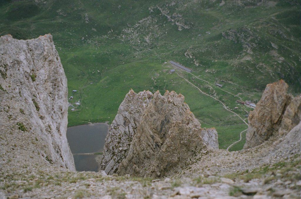
A bit more walking and you find yourself at the start of the last part of the route... with a view down to the lac inferieur de Fully.

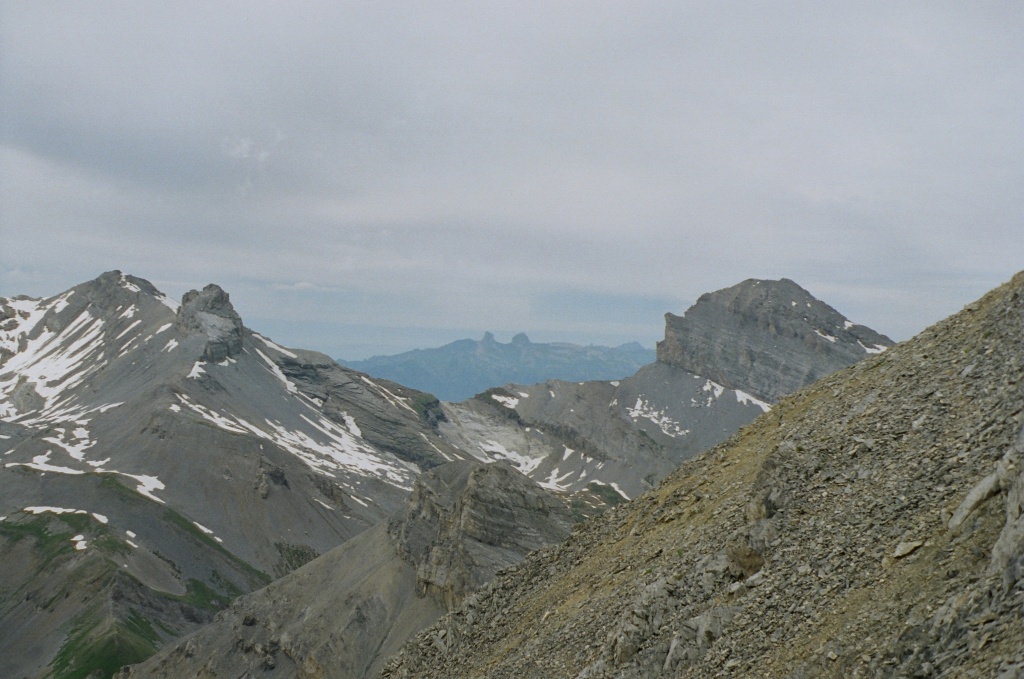
The trail is not so steep here, but at some point it enters rocky terrain and the lack of oxygen starts to become noticeable. However, you do get some great views. I think the two stones far away are the two towers: Tour d'Ai and Tour de Mayen.


Further on is the lac superieur de Fully.


And finally... the peak - the final part is quite difficult and it is very easy to go off trail by mistake (as I did). Unstable and amazingly sharp rocks make going down extremely difficult. I personally had a hard time as I lost the trail amidst the confusing rocks and stopped just 50 meters shy of the cross itself, findind no plausible way of reaching the top. Going back down while being off-trail was difficult due to the loose rocks and soil and the near-certainty of death should you fall (either by tumbling down the very steep slopes, or getting stabbed by the blade-sharp rocks).
But it was fun!
You can view the rest of the pictures here

Monday, July 10, 2006

Lac d'Emosson

I went to the Lac d'Emosson one more time (the third time in total). This time it was a slow hike, with many stops along the way. The weather was not bad, but there was still a lot of snow.


The ground was criss-crossed with streams from the snowmelt and parts of the trail were covered with snow, forcing us to take relatively long detours and perform short climbs over rocky terrain.

At the end we reached the Col de Barberine quite late and we took the unwise decision to try and climbing one of the near peaks. There was no trail, however, and Katerina being an inexperienced hiker without proper shoes meant that our progress was very slow. In the end we turned back much before attaining the peak.

Coming back at the Col, we came across a few Chamoix.
We watched them jump around for a bit and then we turned back. The amount of water had increased a lot by then and crossing the streams was much more difficult. Katerina was quite tired, as a result of which she slipped and fell into a stream. We were still quite far away from the end of the trail (5Km to go on an asphalt road) and I had already used the second pair of socks. However we were lucky - a car belonging to a shepherd was just coming back and gave us a ride to our car. A real deus ex machina.

Tuesday, July 04, 2006

With a camel under Gd Chavalard


Eva, Olga and Sarka came to visit me. One day, I went to what I promised to be an easy hike with them.
However, things were not so easy. After failing to find the road taking us to the highest possible point, we left the car in the middle of some vineyards over Fully before finally discovering the actual road to the top on foot. We crossed the stream that traverses the middle of Grand Chavalard on the south side around an hour later. The snow there is still not melted.


Some time later we had arrived at Chiboz. The steep hike up to the ridge under Gd Chavalard's peak would have taken at least one hour - going back down the same way was ruled out by the girls. So we had to go back another way. There was only one alternative path, which I had never tried before and which was a bit longer, so I was afraid that we might be late. In the end we took this one, and my fears of being late turned out to had been well justified.


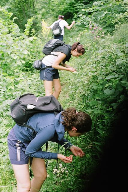
What is it with girls and foraging for berries? It's not as if we were hungry. Fortunately, even if this behaviour corresponded to some primeval hunter-gatherer instinct, it was sated in ten minutes or so and we continued on the unknown trail.
After some time wandering we reached a cliffside and continued along it and through a small village.


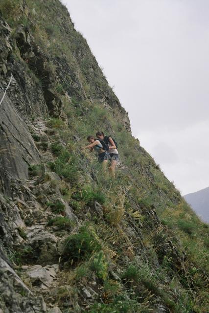
The trail so far had not been particularly hard, but we encountered a sign saying 'difficult trail ahead'. I was not particularly worried at the moment, but we ended up here.


Unfortunately Sarka sufferred from acrophobia and she had to hold on to the chain pretty tightly.. as for me, I seem to have rid of any lingering acrophobia completely and felt perfectly comfortable here, so I think it is time for me to tackle Gd Chavalard!

Anyway, that night - or some other night - we went down to the amphitheater, made friends with a camel and had a bottle of wine.