Friday, July 28, 2006

Grand Chavalard


On Sunday July 16, I decided to tackle Grand Chavalard (see this page for a description and maps) . My aim was to start from Erie and make it to the top in under 2 hours.

The first part of the route is easy: a wide, flat trail, gently going upwards. It follows the cliffside and thus offers a great view over the valley. It also offers a great initial conditioning for looking down extremely steep cslopes. The technically and physically easy part ends when you reach the nearly invisible path that leads up to the avalanche barriers.


The trail to the barriers is on a 45+ degree slope and it zig-zags a lot - it is also slightly inclined and requires a sure foot, but is otherwise not too difficult. If you are afraid of heights you will understand it when you have arrived at this point.
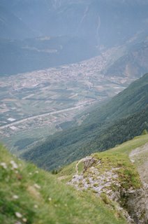
Later on, the trail arrives at a large rocky crevice that is extremely steep and that requires some experience, although it is not particularly dangerous in dry weather (but I wouldn't try it after a rain). Many crows flied overhead, surprised by my ascent. After considerable effort I arrived at a slightly easier path onto grass, just under the avalanche barriers.


Going through the avalanche barriers was fun! The path was steep and went at some places around the barriers, while at others there little doors through which it passed to the other side. At some point you exit the barrier region.. and the view is magnificent:

A bit more walking and you find yourself at the start of the last part of the route... with a view down to the lac inferieur de Fully.

The trail is not so steep here, but at some point it enters rocky terrain and the lack of oxygen starts to become noticeable. However, you do get some great views. I think the two stones far away are the two towers: Tour d'Ai and Tour de Mayen.


Further on is the lac superieur de Fully.


And finally... the peak - the final part is quite difficult and it is very easy to go off trail by mistake (as I did). Unstable and amazingly sharp rocks make going down extremely difficult. I personally had a hard time as I lost the trail amidst the confusing rocks and stopped just 50 meters shy of the cross itself, findind no plausible way of reaching the top. Going back down while being off-trail was difficult due to the loose rocks and soil and the near-certainty of death should you fall (either by tumbling down the very steep slopes, or getting stabbed by the blade-sharp rocks).
But it was fun!
You can view the rest of the pictures here

Monday, July 10, 2006

Lac d'Emosson

I went to the Lac d'Emosson one more time (the third time in total). This time it was a slow hike, with many stops along the way. The weather was not bad, but there was still a lot of snow.


The ground was criss-crossed with streams from the snowmelt and parts of the trail were covered with snow, forcing us to take relatively long detours and perform short climbs over rocky terrain.

At the end we reached the Col de Barberine quite late and we took the unwise decision to try and climbing one of the near peaks. There was no trail, however, and Katerina being an inexperienced hiker without proper shoes meant that our progress was very slow. In the end we turned back much before attaining the peak.

Coming back at the Col, we came across a few Chamoix.
We watched them jump around for a bit and then we turned back. The amount of water had increased a lot by then and crossing the streams was much more difficult. Katerina was quite tired, as a result of which she slipped and fell into a stream. We were still quite far away from the end of the trail (5Km to go on an asphalt road) and I had already used the second pair of socks. However we were lucky - a car belonging to a shepherd was just coming back and gave us a ride to our car. A real deus ex machina.

Tuesday, July 04, 2006

With a camel under Gd Chavalard


Eva, Olga and Sarka came to visit me. One day, I went to what I promised to be an easy hike with them.
However, things were not so easy. After failing to find the road taking us to the highest possible point, we left the car in the middle of some vineyards over Fully before finally discovering the actual road to the top on foot. We crossed the stream that traverses the middle of Grand Chavalard on the south side around an hour later. The snow there is still not melted.


Some time later we had arrived at Chiboz. The steep hike up to the ridge under Gd Chavalard's peak would have taken at least one hour - going back down the same way was ruled out by the girls. So we had to go back another way. There was only one alternative path, which I had never tried before and which was a bit longer, so I was afraid that we might be late. In the end we took this one, and my fears of being late turned out to had been well justified.


What is it with girls and foraging for berries? It's not as if we were hungry. Fortunately, even if this behaviour corresponded to some primeval hunter-gatherer instinct, it was sated in ten minutes or so and we continued on the unknown trail.
After some time wandering we reached a cliffside and continued along it and through a small village.


The trail so far had not been particularly hard, but we encountered a sign saying 'difficult trail ahead'. I was not particularly worried at the moment, but we ended up here.


Unfortunately Sarka sufferred from acrophobia and she had to hold on to the chain pretty tightly.. as for me, I seem to have rid of any lingering acrophobia completely and felt perfectly comfortable here, so I think it is time for me to tackle Gd Chavalard!

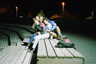
Anyway, that night - or some other night - we went down to the amphitheater, made friends with a camel and had a bottle of wine.